| | | Sublibrary | Roll No | Photo No | Roll/Box Subject | Description | Year Taken |
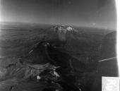 | View | North Island | Run1-45 | 1 | Ruapehu to Rupuhia | Ngaruahoe to Ruapehu | 1947 |
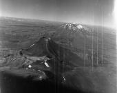 | View | North Island | Run1-45 | 2 | Ruapehu to Rupuhia | Ngaruahoe to Ruapehu | 1947 |
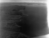
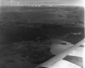 | View | North Island | Run1-45 | 3 | Ruapehu to Rupuhia | Looking NNE to Lake Taupo from above Lake Rotoaria bottom right | 1947 |
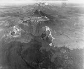 | View | North Island | Run1-45 | 4 | Ruapehu to Rupuhia | Ngaruahoe to Ruapehu | 1947 |
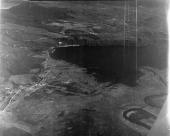 | View | North Island | Run1-45 | 5 | Ruapehu to Rupuhia | Looking NW down Tongariro River bottom right and over Tokaanu below centre left to Kuharua (peak) top left | 1947 |
 | View | North Island | Run1-45 | 6 | Ruapehu to Rupuhia | Looking WNW over Tokaanu below centre left and over Waihi Bay, Lake Taupo to Kuharua (peak) centre top | 1947 |
 | View | North Island | Run1-45 | 7 | Ruapehu to Rupuhia | Looking NNE over Lake Taupo to Tapuaeharuru Bay and Tauhara (peak) top right | 1947 |
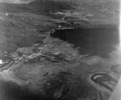
 | View | North Island | Run1-45 | 8 | Ruapehu to Rupuhia | Looking SE up Tongariro River and over Turangi left centre to Kaimanawa Range in distance. Intersection of Te Awamate Rd. and Tokaanu Rd. (then main highway, later Hiranga Rd.) right of bottom centre | 1947 |
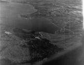
 | View | North Island | Run1-45 | 9 | Ruapehu to Rupuhia | Looking NNE along SW shore of Lake Taupo. Kuratau River enters lake centre. Rangitukura (peak) above and left of centre. Pukawa Bay below centre | 1947 |
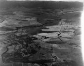
 | View | North Island | Run1-45 | 10 | Ruapehu to Rupuhia | Looking East over Tongariro River delta and Lake Taupo. Tokaanu centre right | 1947 |
|